Ploo Sektor: Unterschied zwischen den Versionen
Aus Holopedia
Zur Navigation springenZur Suche springen| Zeile 1: | Zeile 1: | ||
[[Kategorie:Sektoren]] | [[Kategorie:Sektoren]] | ||
[[Kategorie:Expansions Regions Cluster]] | [[Kategorie:Expansions Regions Cluster]] | ||
| − | [[ | + | [[Kategorie:Ploo Sektor]] |
[[Kategorie:Hydianische Handelsstraße]] | [[Kategorie:Hydianische Handelsstraße]] | ||
[[Kategorie:Mandalorische Handelsroute]] | [[Kategorie:Mandalorische Handelsroute]] | ||
Aktuelle Version vom 16. Juni 2019, 15:09 Uhr
< Die Galaxie < Expansions Regions Cluster < Ploo Sektor
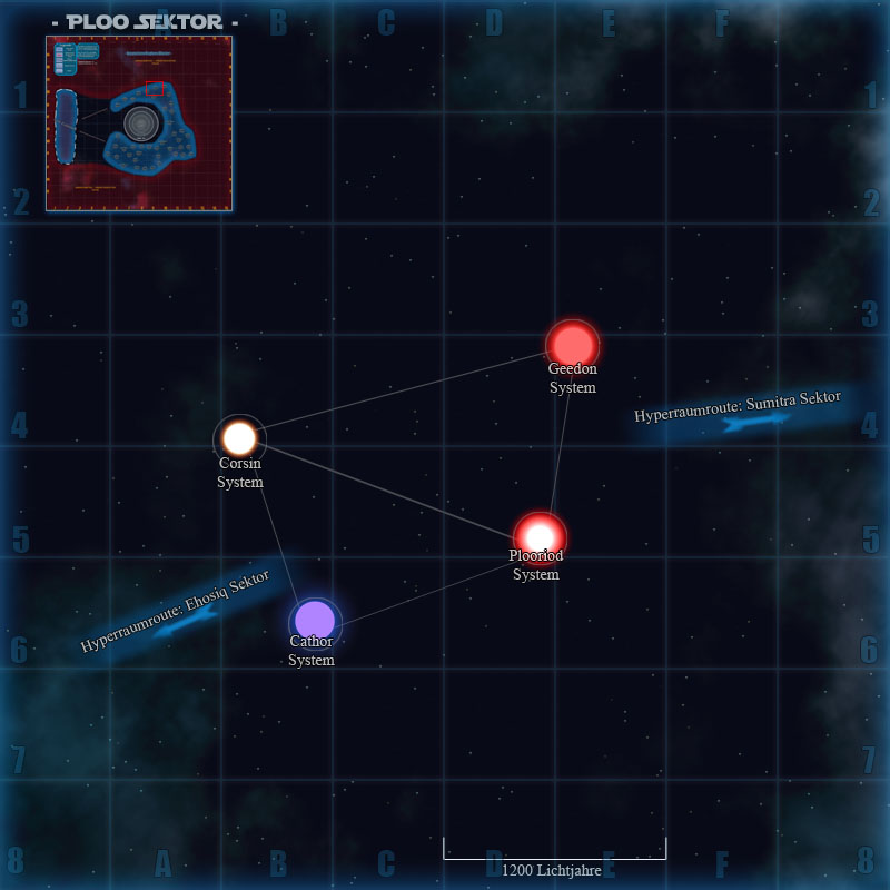
| Taktische Karte des Ploo Sektors ( Die Systeme auf der Grafik können angeklickt werden ) | ||||||||
| ||||||||
